


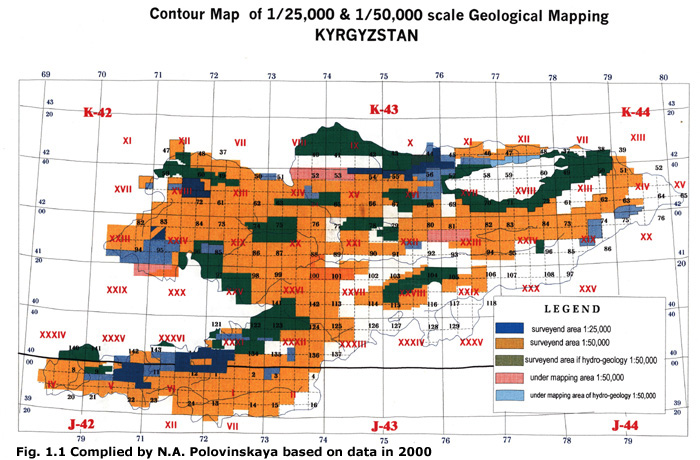
Systematic mapping has been carried out in Kyrgyzstan since 1970. Today, more than 80% of the Kyrgyz territory has been surveyed and results were produced on maps at the 1:50 000 scale (Fig. 1.1). However, the original documents are not uniform and a synthetic, generalized picture becomes indispensable to develop and pay credit to this work. These data are no longer classified as confidential but are unfortunately archived in various Kyrgyz institutions. Homogenization and publication had become an urgent task to fill a gap in the scientific knowledge of a fascinating and actively growing mountain region. The importance of digital maps increases today because the only one map published on the region is an old USSR document at the imprecise 1: 500 000 scale with information given in Russian. Translation of the information makes it accessible to the international English-speaking community
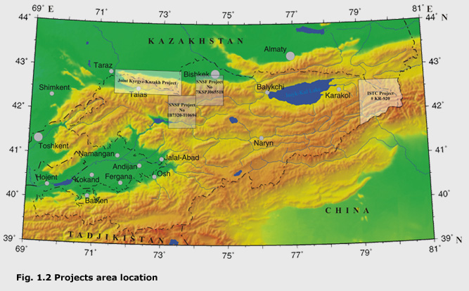
Owing to the financial support of the SNSF the first digital geological map in Kyrgyzstan had been created by 2004 (SNSF Project No 7KSPJ065518). The result of the SCOPES Program 2005-2008 is a prolongation of these labours (SNSF Project No IB7320-110694). Our colleagues from Kazakhstan were enthusiastic over the first success on this field of geological research and they decided to participate in the Joint Kyrgyz-Kazakh Project. ISTC experts agreed with a necessity to create a digital geological map of the Khan-Tengri Plexus of mountains which is a place very difficult to access and the highest part of the Tien-Shan (ISTC Project # KR-920). We are sure that the dynamic development of the GIS technology in geological researches of Kyrgyzstan will increase and we will try to show these results in this website opportunely.
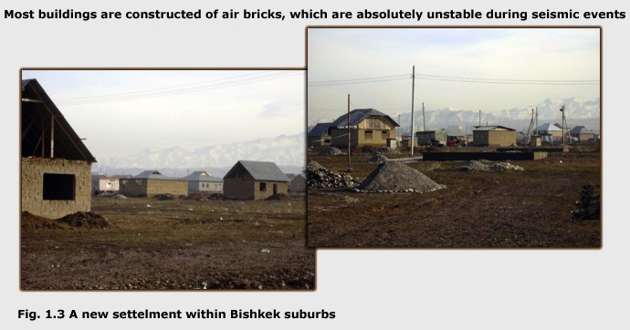
The main goal of the SNSF Project No 7KSPJ065518 was to create a digital geological map at the 1: 200 000 scale based on unpublished geological surveys of the Kyrgyzstan geologists on the most populated region of Kyrgyzstan, including suburbs of Bishkek, the capital and numerous uncontrolled settlements of migrating rural populations (Fig. 1.3).
Therefore, collecting information on the seismicity, hydrogeology and natural hazards of the region has been given special consideration. During elaboration of the map, we used the archived material and we carried out focused fieldwork to control crucial geological relationships. We anticipate that this map will be practical to scientists and industry/engineering contractors.
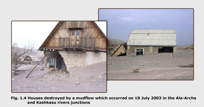
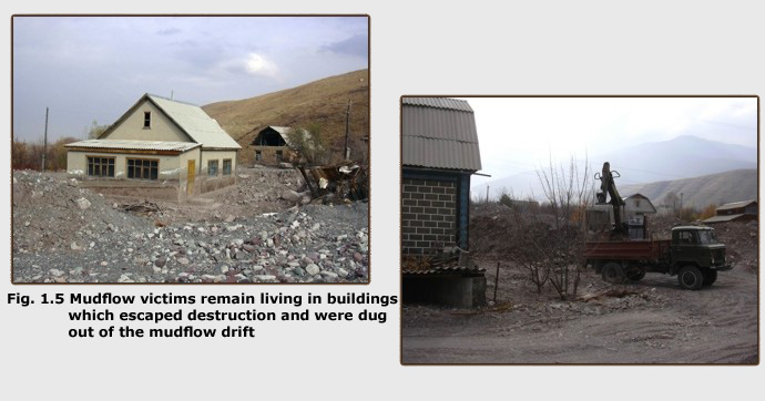
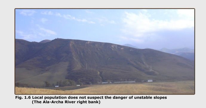
A mudflow occurred in the Ala-Archa River on July19th, 2003, which caused anxiety to the Bishkek citizens for several days. This concern reflects the lack of awareness concerning such natural hazards so that, over the last decade, more inhabitants settled in mountain flood-lands without any permission. Since the USSR state-control of land property has practically disappeared, information on environmental conditions (seismic, hydrogeological hazards, land conditions, etc.) in a freely accessible digital format is very efficient means to solve engineering and social problems because it is cheap to implement and is accessible to everyone (Fig.1.4-1.6).
At carry out of SNSF Project No IB7320-110694 the basic attention was given to an estimation of seismic danger of Suusamyr area (pga_map_itsh08.pdf)
Various data on the covered region have been compiled in the packet of maps presented as PDF files:
1. Geological Map
2. Quaternary Removed Geological Map
3. Quaternary Geological Map
4. Map of Exogenic Geological Hazard
5. Map of Seismic Hazard Zoning
A brief explanatory note describing characteristics of the geological formations accompanies the Geological Map. More complete information can be found in the ArcGIS database where formalized description of the maps was in the following sequence:
1.1 Definition of geological units according to age divisions (Paleozoic and Cenozoic complexes)1.2 Definition of geological units according to age divisions (Quaternary deposits)
1.3 Definition of lithological and magmatic facies
1.4 Hierarchisation of faults (Paleozoic and Cenozoic)
1.5 Hierarchisation of faults (Quaternary)
1.6 Isolines of depth from the sea level to a basement
1.7 Input of orientation data (strike and dip of strata and foliations)
1.8 Location of fossil sites
1.9 Location of isotope age samples
1.10 Location of the geochemical data
1.11 Isolines of depth from the surface to an aquifer
1.12 Earthquake hypocenters
1.13 The mechanism of the earthquakes
1.14 Position of seismodislocation
1.15 Zones of seismic danger
1.16 Technogenic objects
1.17 Topographical map
We invite users needing more information for any specific goal, to contact the Kyrgyz full investigators identified in metafiles accompanying each layer mentioned above.